 ArcView Tutorial 2: Creating Access Maps ArcView Tutorial 2: Creating Access Maps
Adding DNR's Land Status
DNR created a coverage for statewide land status based on 1996 information
that is the most
comprehensive source available. This does not mean, however, that it fills
all of our needs.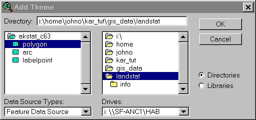 It was created at the section level, meaning that if a
mixture of federal, state, and private land exist within a section the land
status will generally be shown as entirely private or entirely federal, etc. This
coverage is quite large so
you will have to clip it in the same
fashion as we did with the sections coverage. Add the
landstatus theme
It was created at the section level, meaning that if a
mixture of federal, state, and private land exist within a section the land
status will generally be shown as entirely private or entirely federal, etc. This
coverage is quite large so
you will have to clip it in the same
fashion as we did with the sections coverage. Add the
landstatus theme  ; zoom out a
bit
; zoom out a
bit ; activate theme; select tool
 ; select and area a bit bigger than you need; create
shape file and name it landstat.shp; add it to the view; turn off the old
; select and area a bit bigger than you need; create
shape file and name it landstat.shp; add it to the view; turn off the old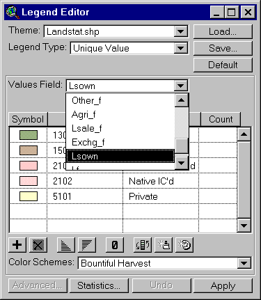 theme and turn the new one on;
2x the new landstat theme; Legend Type: Unique Value; Values Field: Lsown; Save
button; save as landstat.avl in your folder. This last step will
save the legend symbol values. Generally we use brown or green for
federal, blues for state, pinks for native land, and yellow for private.
Look at the examples. DNR didn't add a list of
the landowners in the theme table, conveniently enough, so a list corresponding
to the four number Lsown codes is available
in Appendix 2. Select the activated theme; 2x
the theme; change the "Label" field from the number to the
corresponding owner from Appendix 2. This will change the values on the
themes bar in the view as well.
theme and turn the new one on;
2x the new landstat theme; Legend Type: Unique Value; Values Field: Lsown; Save
button; save as landstat.avl in your folder. This last step will
save the legend symbol values. Generally we use brown or green for
federal, blues for state, pinks for native land, and yellow for private.
Look at the examples. DNR didn't add a list of
the landowners in the theme table, conveniently enough, so a list corresponding
to the four number Lsown codes is available
in Appendix 2. Select the activated theme; 2x
the theme; change the "Label" field from the number to the
corresponding owner from Appendix 2. This will change the values on the
themes bar in the view as well.
Continue with Tutorial
Previous item in Tutorial
Return to ArcView Tutorial 2: List of Topics
Return to Main Menu