 ArcView Tutorial 2: Creating Access Maps ArcView Tutorial 2: Creating Access Maps
Printing and Exporting the Finished Product
The easiest way to print or export in ArcView is through ArcPress, which is a program produced by ESRI that allows you to print large graphics files. Generally, when you send a file to a printer the printer must process the file with it's own memory, which significantly slows down the printing process. ArcPress allows the processing to occur on your local computer first, which is much faster than remote processing on the printer. You have various options available out of ArcPress besides printing, such as exporting files as JPG or TIF graphic formats.
Printing
You can get to ArcPress via the File menu or you may have a button on
the toolbar. When you start the program you will get the lower left
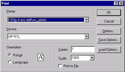
window; choose "Print" and another window (lower right) will open with
two dialog boxes called "Printer" and "Device". In the
top dialog box choose "\\Dfg-sf-anc-dell\wc_plotter" and leave the
bottom box as "HP RTL". There is also a box for scale, where you
can choose a percentage of size, larger or smaller, as well as a number of
copies box. When you are done click "OK" and ArcPress will
process and print the file.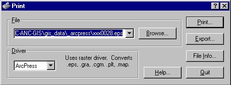
Export Graphics
You can also export finished layouts using ArcPress. To accomplish this, click the "Export" button on the first ArcPress window (above left). The Export window (below left) will open. First, choose the drive you want to save the file in, and then scroll in the Directories window to the directory you want. Next, choose the Export Format, and finally add a name in the "File Name" dialog.
You have the option of saving in several formats although I would suggest
either JPG or TIF, the latter being the highest quality but also the largest
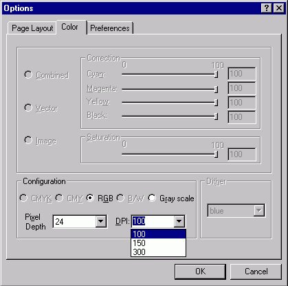
(20+ MB for an average file). The Options button in the Export box will
take you to the Options window (below right), where you can go to the Color tab
and determine the DPI (dots per inch) of the file. I would suggests 150 or
300 but keep in mind that the greater the DPI, the greater the file size. 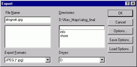
Go on to Tutorial 3: Creating ISF Maps
Previous item in Tutorial
Return to ArcView Tutorial 2: List of Topics
Return to Main Menu